 HeliChart- USA Helicopter Maps


HeliChart- Offline moving USA Helicopter Maps of major cities.
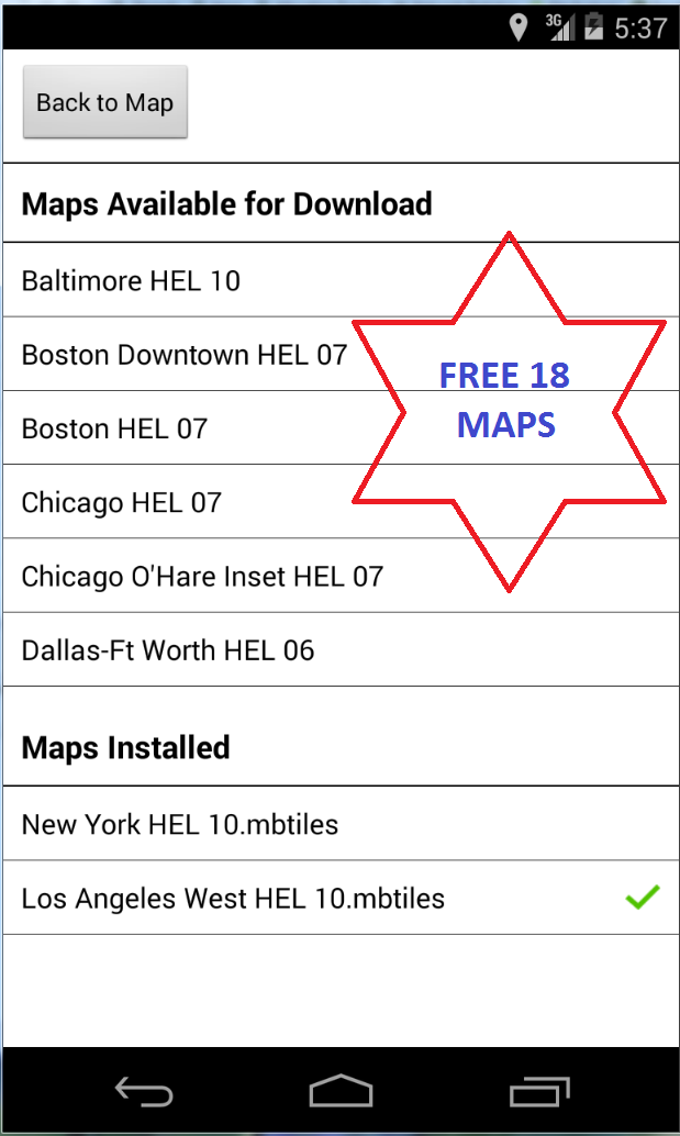
HeliChart provides offline moving USA Helicopter Maps of major cities.. It includes all 18 helicopter charts of major cities provided by official navigator charts by FAA. Download more charts as you please free of charge. You get unlimited charts database update with this app. All charts work as self contained in offline mode where you do not need any network connections (Wifi or 4G). Your current location is shown on a moving map with helicopter icon centered around it. Green update icon will toggle GPS ON and OFF. When GPS is ON, map is automatically centered around current location. To pan maps, turn GPS update OFF and browse map with a swipe. Swipe screen and hit zoom button to zoom in and out. *Easy to use and learn*Real-time GPS tracks and navigation*Terrain maps major USA cities*Add custom markers and way-points for route planning*Location icon can be centered or track from your placement on screen.*All 14 USA Helicopter Maps provided free with no in-app purchases*Made by and for pilots*Quick and responsive*Runs on most Android devices*No ads or invasive permissionhttp://airplanegroundschools.com/android/usahelicharts-usa-helicopter-maps.php
HeliChart provides offline moving USA Helicopter Maps of major cities.. It includes all 18 helicopter charts of major cities provided by official navigator charts by FAA. Download more charts as you please free of charge. You get unlimited charts database update with this app. All charts work as self contained in offline mode where you do not need any network connections (Wifi or 4G). Your current location is shown on a moving map with helicopter icon centered around it. Green update icon will toggle GPS ON and OFF. When GPS is ON, map is automatically centered around current location. To pan maps, turn GPS update OFF and browse map with a swipe. Swipe screen and hit zoom button to zoom in and out. *Easy to use and learn*Real-time GPS tracks and navigation*Terrain maps major USA cities*Add custom markers and way-points for route planning*Location icon can be centered or track from your placement on screen.*All 14 USA Helicopter Maps provided free with no in-app purchases*Made by and for pilots*Quick and responsive*Runs on most Android devices*No ads or invasive permissionhttp://airplanegroundschools.com/android/usahelicharts-usa-helicopter-maps.php